ENVIRONMENTAL GRAPHICS & MURALS
Environmental Graphics - Selected Works
Orientation & Way-finding
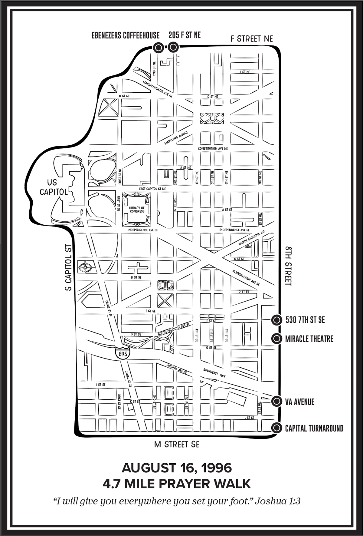
Capitol Turnaround - Prayer Map
This illustrated prayer walk map was inspired by a 4.7-mile route around Capitol Hill, developed in connection with Capital Turnaround and influenced by Mark Batterson’s prayer walk practice, later described in his book The Circle Maker. The map translates a spiritual journey into a clear, legible graphic system—blending cartographic structure with symbolic intent.
Designed as both a navigational tool and a commemorative artifact, the piece abstracts the urban grid into a continuous walking path that traces civic landmarks and neighborhood boundaries. The simplified line work emphasizes movement, repetition, and enclosure, reflecting the act of walking as both physical and reflective practice.
The project demonstrates how mapping and environmental graphics can extend beyond wayfinding to communicate experience, ritual, and meaning—using design to give form to an otherwise intangible journey.
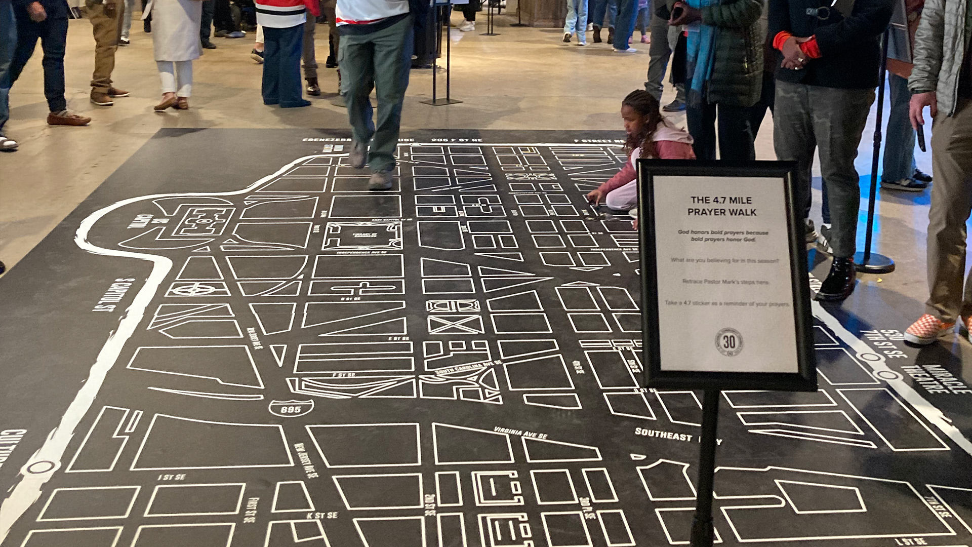
The 4.7 Prayer Walk map on display at the NCC 30 Year Celebration
Environmental Graphics - Selected Works
Brand & Identity
Coke/Sprite Graphics
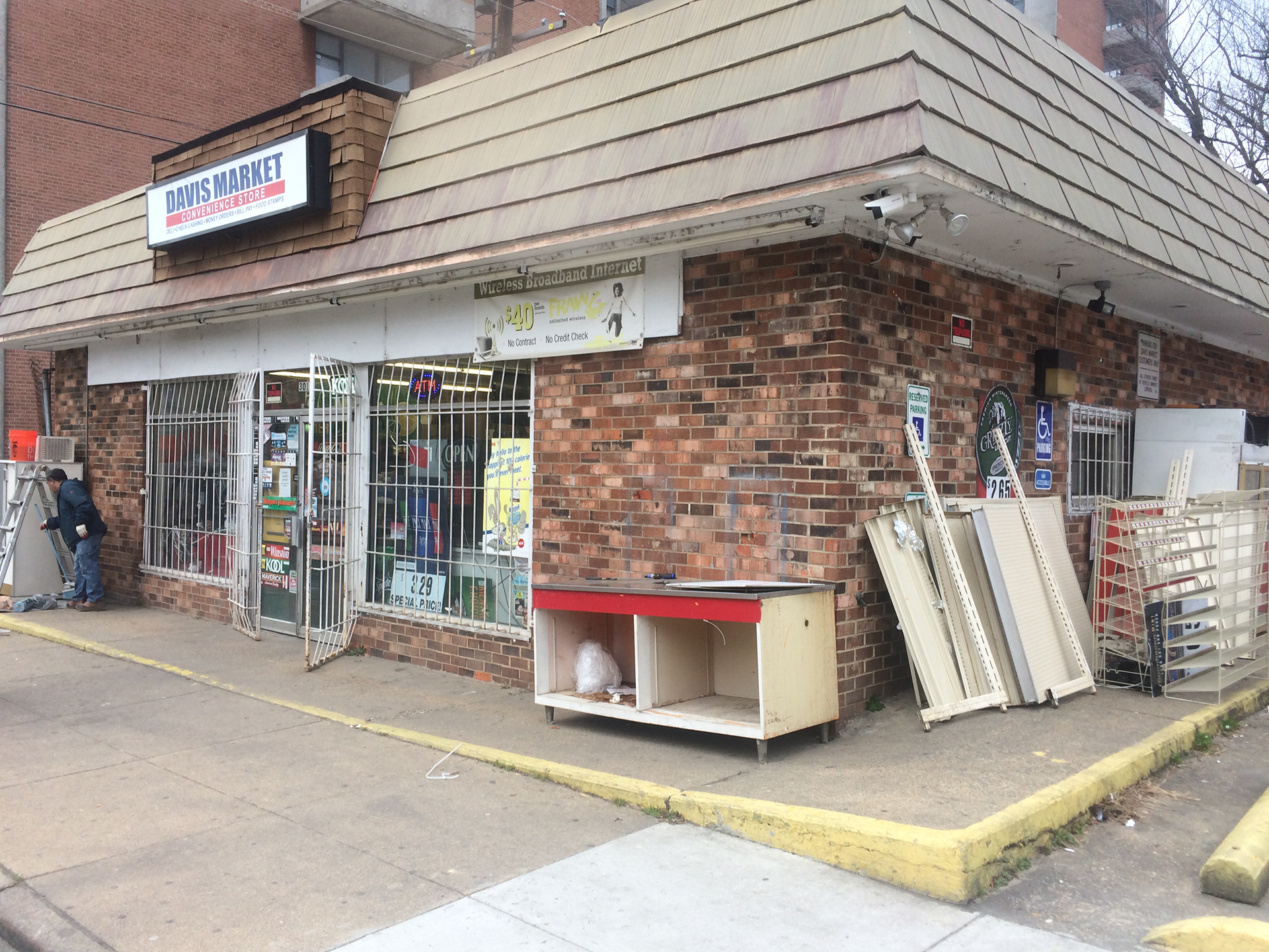
This environmental graphics project transforms a neighborhood corner store using the visual language of iconic beverage branding. The work required strict adherence to proprietary corporate brand guidelines, including approved color systems and material specifications provided under nondisclosure.
Drawing from mid-century Coca-Cola wall signage and contemporary Sprite branding, the intervention integrates typography, color, and architecture to create a cohesive storefront identity while working within existing security grates and brick surfaces.
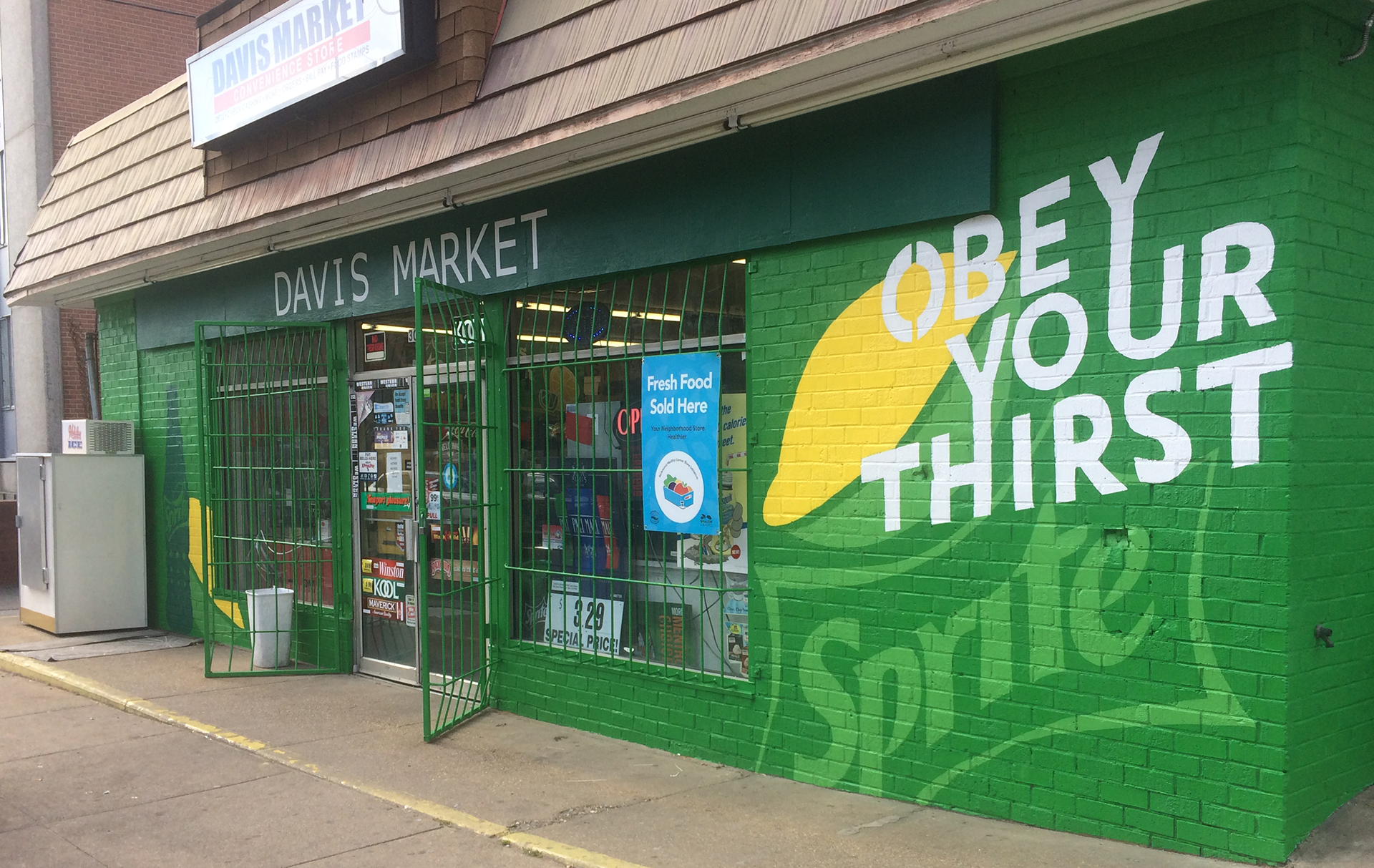
Before
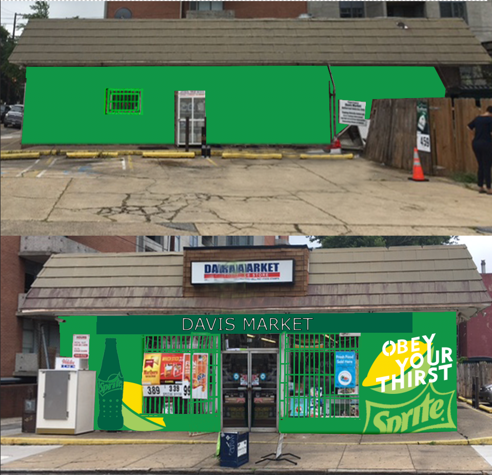
Concept Rendering
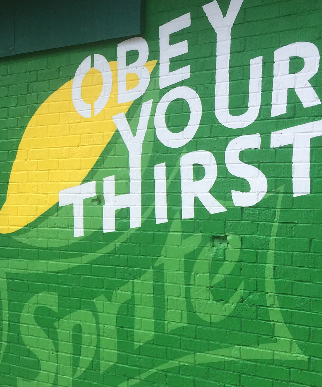
Close-up
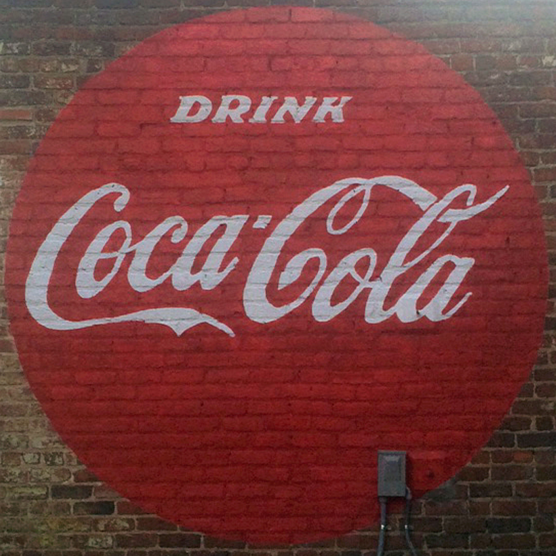
Historic Coca-Cola signage
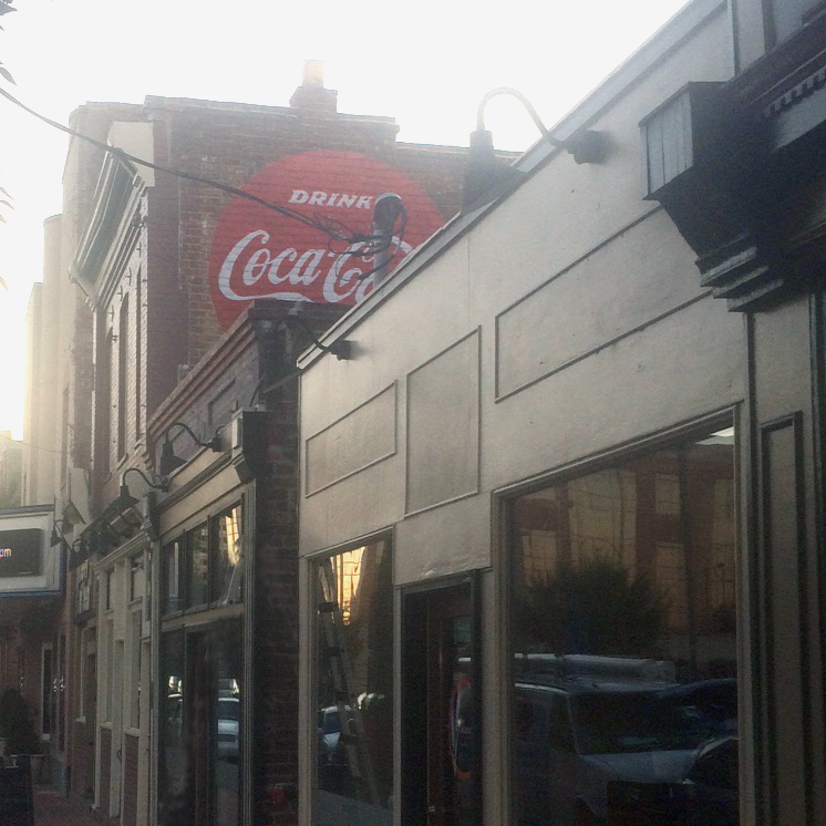
Street Context
Environmental Graphics - Selected Works
Site-Specific Graphic Systems
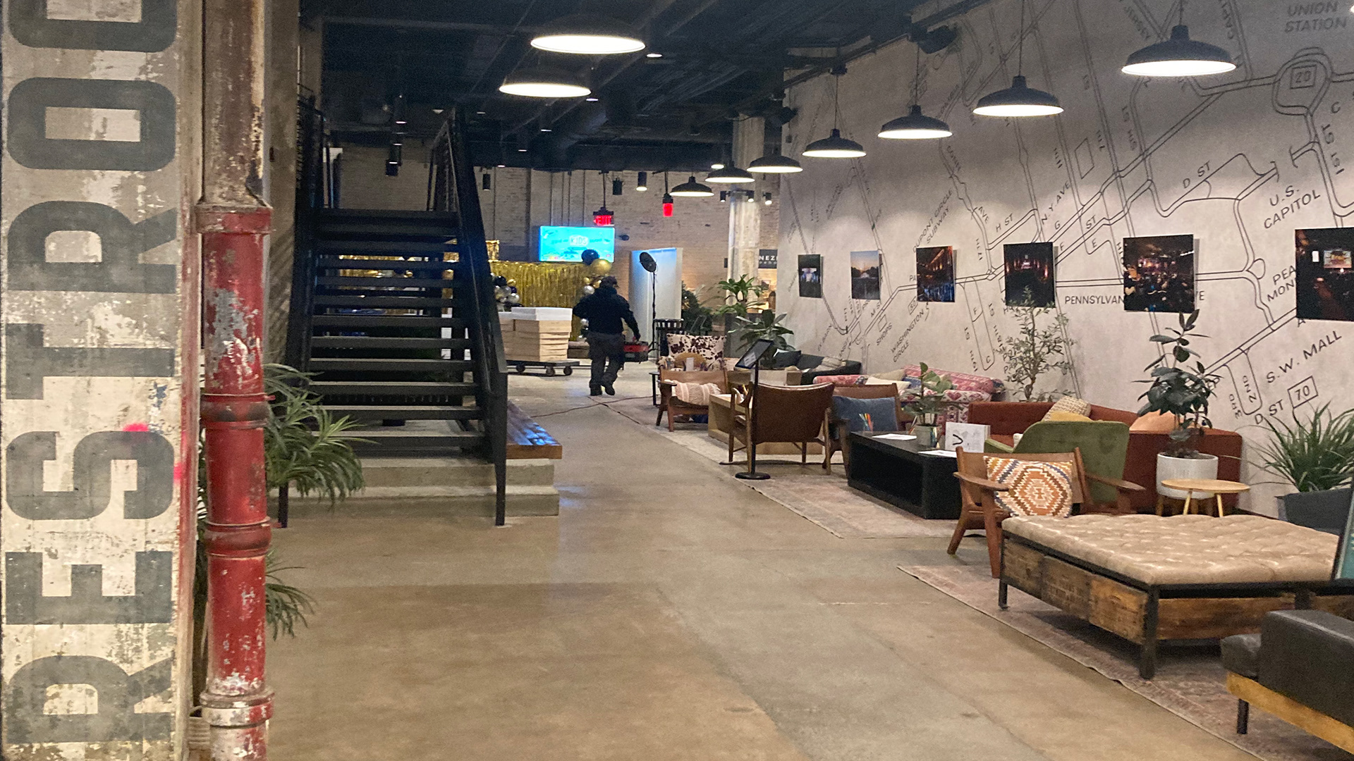
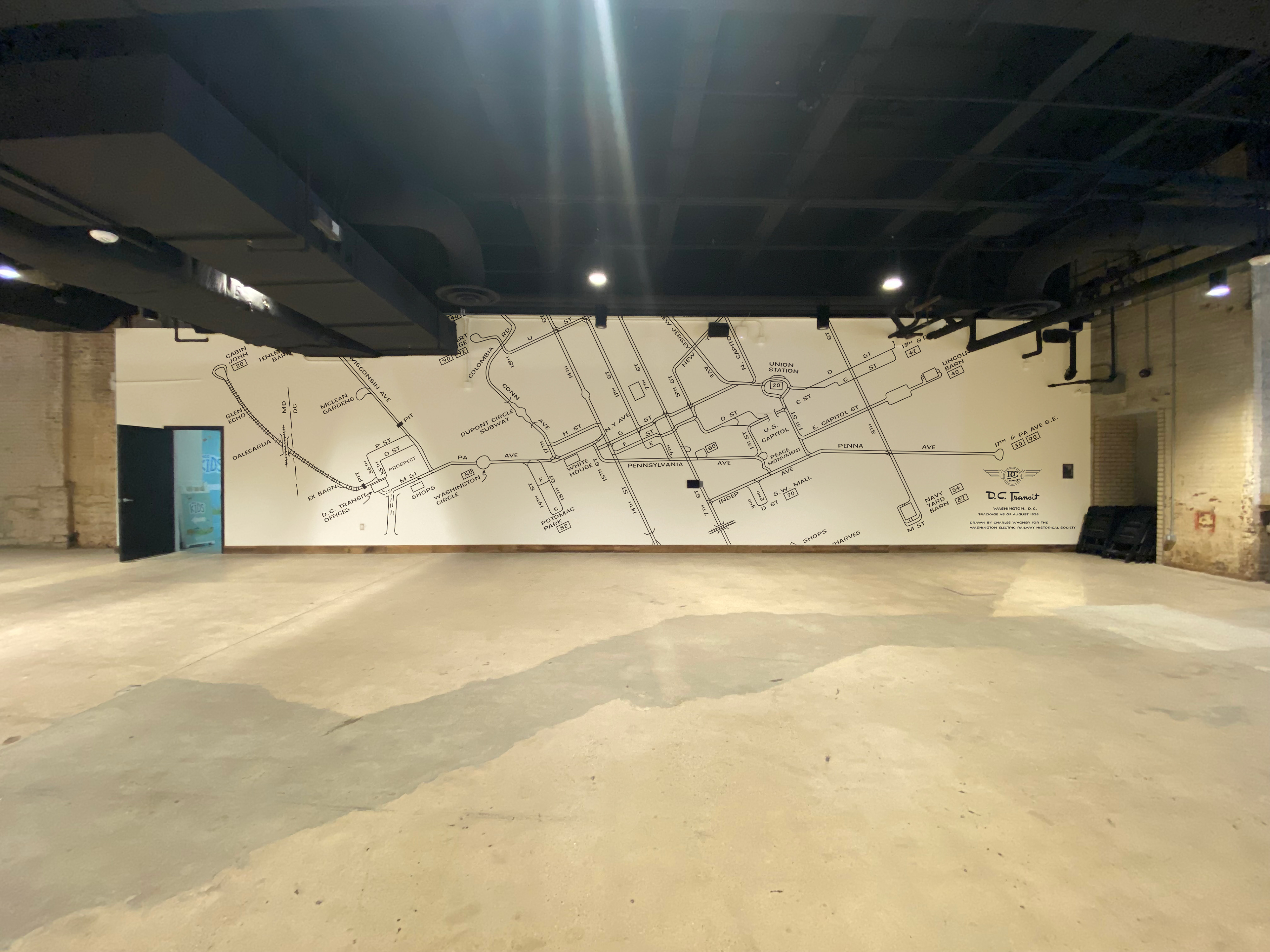
Turnaround - Cable Car Mural
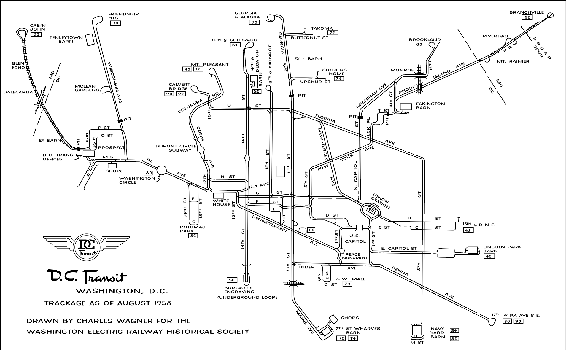
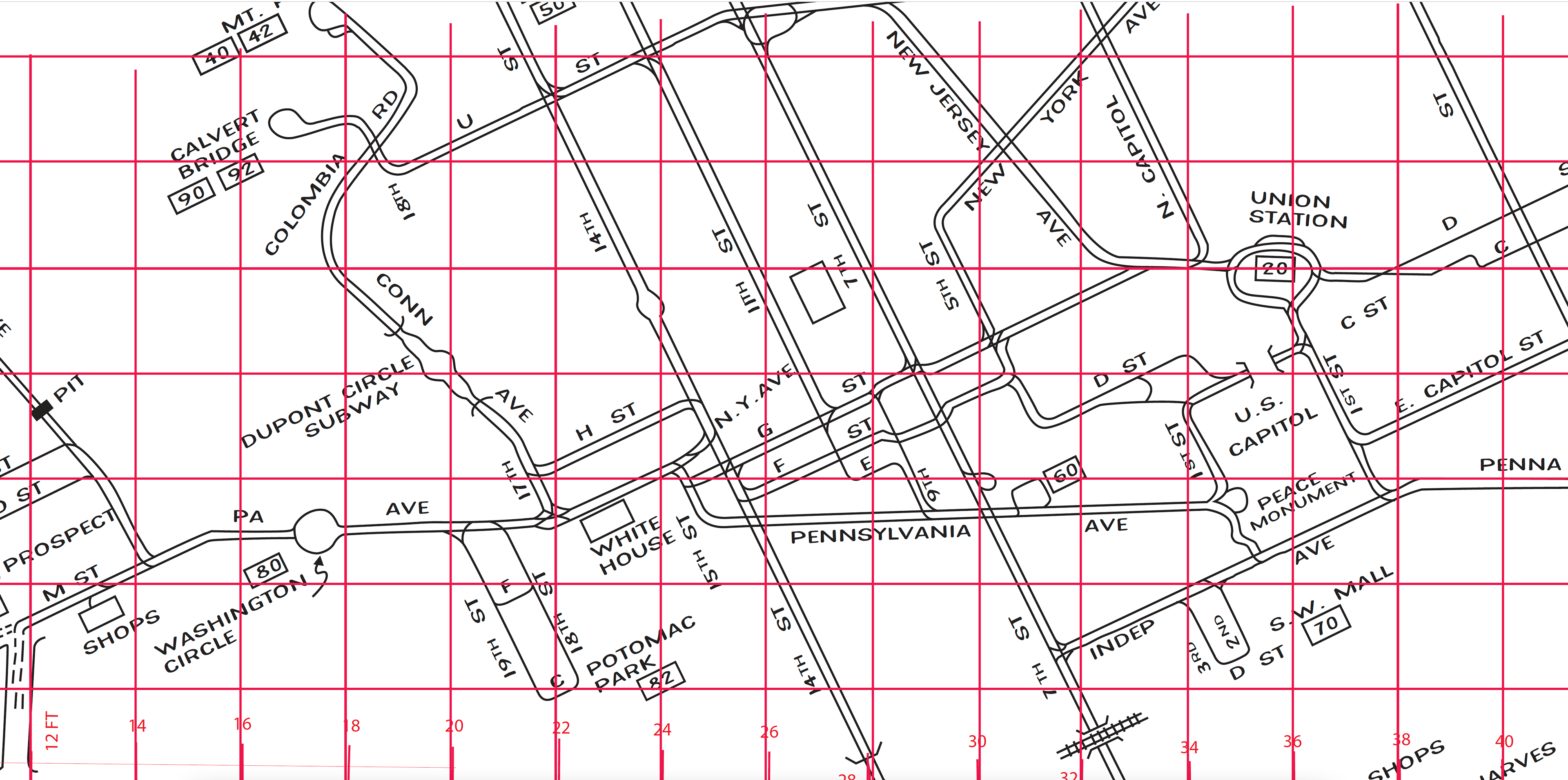
This project involved the site-specific reproduction and architectural scaling of a historic Washington, D.C. transit map originally designed by Charles Wagner. The map was carefully redrawn in Adobe Illustrator, preserving the original graphic language, line hierarchy, and typographic structure while preparing it for large-scale installation.
Custom stencils were fabricated using a plotter and applied on site to transfer the artwork across a wall over 17 feet high and more than 60 feet long, spanning three connected wall planes. Precise scaling, alignment, and registration ensured continuity across architectural breaks.
The completed mural preserves and recontextualizes a piece of transit history within the built environment, allowing archival graphic design to be experienced at an architectural scale.
Original Map drawn by Charles Wagner

Custom stencils plotted and applied on site to transfer the map at full scale.
Wall Mock-Up
Wall Before
Digitally redrawn and reconstructed in Adobe Illustrator to preserve original graphic structure while enabling architectural scaling.